|
nb3_keating
 Return to First Page Return to First Page
The Keatings Explore New Brunswick, Part 3
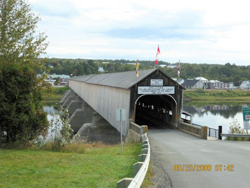 |
| Hartland Bridge WGN 55-02-07 |
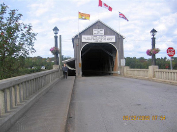 |
| Hartland Bridge and Liz Keating |
Hi Folks
On Sunday, Sept. 20, we took the Trans Canada Highway (Rte 2) to Hartland, to visit the longest covered bridge in the world at 1282 ft-it's been on Liz' wish list for a while.
I have attached two pictures of the Hartland bridge, one with Liz, and pictures of the two plaques. The bridge is easy to find, with signs on Rte 2 leading you to the bridge. We parked and walked across the bridge (it has a sidewalk). It is a one-lane bridge without a traffic light. You turn your headlights on and look for headlights at the other end before you cross.
There is an information center in Hartland at the end of the bridge. I asked the lady if they had any covered bridge tour pamphlets. She only had Carleton county (Hartland -Woodstock) tour brochures, which I gratefully accepted. There is a gift shop between the bridge and Rte 2. We stopped there and Liz bought, among other things, some "Covered Bridge potato chips."
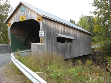
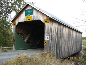
We then drove north to Victoria county and Tomlinson Mill bridge. I think the roofed window is interesting.
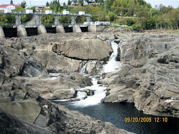
We continued north, stopping in Grand Falls to see the Grand Falls, not very grand at this time (see photo). We were now in French Canadian territory. I asked directions from some teenagers, who responded in French that I couldn't understand (40 years since college French). New Brunswick is very proud that it is the only official bilingual province in Canada. All road
signs are in French and English or pictographs. One pictograph that I remember on Rte 2 at the approach to a bridge was of a car sliding across 2 lanes, next to a thermometer with the bottom half bright red. I Believe that the English equivalent would be "Bridge freezes before highway."
We drove north and east on rte 2 into Madawaska county (which calls itself "The Republic of Madawaska"). We visited Boniface, and Baker Brook bridges. Baker Brook has been bypassed. Baker Brook is the farthest north that we have been to visit a covered bridge. It is west of Edmunston, located in the finger of New Brunswick sandwiched between the top of Maine and Quebec. We also tried to visit Quisibis River #2 but the road was closed for construction about 3 miles away from the bridge and Liz said "No way am I walking 3 miles for this bridge!"
We then headed back to our motel in Woodstock.
Tom
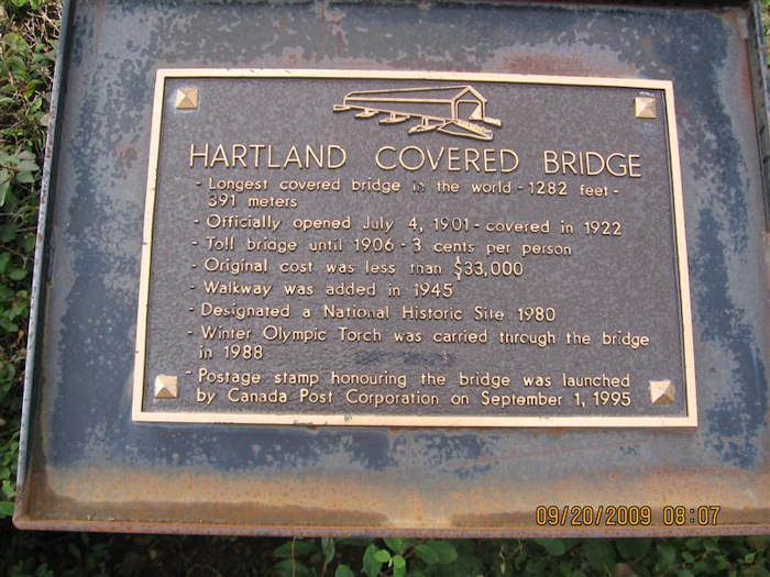 |
| Hartland Bridge sign |
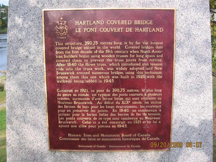 |
| Hartland Bridge bilingual sign |
|
|
| Tomlinson Mill Bridge, WGN 55-13-03
|
Tomlinson Mill Bridge.
|
|

|
| Grand Falls.
|
Boniface Bridge WGN 55-07-02.
|
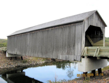 |
| Baker Brook Bridge. WGN 55-07-04 |
Return to top
 Joe Nelson, P.O Box 267, Jericho, VT 05465-0267
This file posted 11/2/2009
|


 Joe Nelson, P.O Box 267, Jericho, VT 05465-0267
This file posted 11/2/2009
 Return to First Page