nagangast

Back to Archive.

My Vermont Covered Bridges by Conrad M. Nagengast

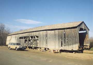
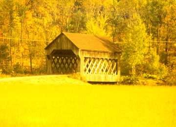
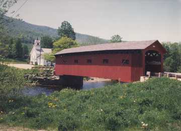
Martin's Mill Bridge. Photo by C. M. Nagengast
November 1977
Martin's Mill Bridge 45-14-01
My first covered bridge except for those near my home in Albion, Erie County, PA.
Photo by C.M. Nagengast November 1977
       My wife and I decided in 1977 that we should take a trip through the northeastern states. I had been to Boston and Portland, Maine when I was in the Navy in 1942. We, Dale and I, flew from Chula Vista, California to Boston and rented an auto to make our tour of the New England states.
       After leaving Boston our trip took us through Maine, New Hampshire and into the Green Mountain State. Driving down along the Connecticut River, we stopped for a "pit stop". In looking over the fence and down I saw a WOODEN COVERED BRIDGE! That was probably the exact moment the love and interest for these wonderful relics of the past commenced for me. We enjoyed traveling, camping,. antiques (Dale), fishing (me) and visiting new areas. The bridge that I saw was Martins Mill.(45-14-01) This remark will no doubt, engender many questions from those better acquainted with the area than this writer.
       I was born in Albion, Erie County, Pennsylvania. Albion is about 128 miles from Buffalo, New York. Albion is about four miles from Sherman (38-25-02), 4 1 /2 miles from Carmen (38-25-05), eight miles from Gudgeonville (38-25-03) and 18 1 /4 miles from Waterford (38- 25-04). Pennside (38-25-01) was still there about 6 miles from Albion when I was a lad. These distances are just estimated. I did not give accurate distances since, hopefully, you will have a World Guide to accomplish that information. Today's maps are of better use than the maps of 1977. The roads, highways and even streets have changed and updated since 1977.
       The ADC Map people publish an excellent Pennsylvania State Road Atlas. DeLorme also puts out a fine Atlas/Gazette. For the people new to the covered bridge world, one should carry with you the following: The latest maps of the area (auto clubs will furnish); a small note-book to record the camera views; a compass (to be able to record the directions such as N portal, E side, SW corner, etc., camera needs; extra film, batteries, comfortable clothing to suit the weather with a complete change in case of dampness; and a pad to take additional notes (road and/or bridge closed or on private land).
       And now back to Vermont. Dale and I returned to the Green Mountain State in May of 1984 and again in October of 1987. I have visited and taken photos of every authentic bridge in Vermont with the following exceptions: Station Bridge (45-01-01), always flooded with the road blocked off; Garfield Village Bridge (45-08-05), moved in 1973 to Windsor County, split in half and made into 45-14-17 and 45-14-18; Flint (45-09-11), the road blocked off and we were unable to approach the bridge; and Mead (45-11-08), "arsoned" 7/22/71.
       I have not given notice to the little bridges known as "Romantic Shelters." I have taken photos of many of these small bridges in my travels but consider that as being not concerned with the preservation of the great marvels of time and the ingenuity of their builders.

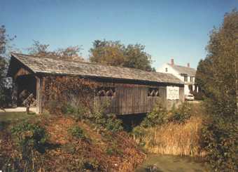
Chiselville Bridge.
Photo by C.M. Nagengast May 1984 Arlington/Bridge-at-the-
Green. Photo by C.M. Nagengast May 1984
Chiselville Bridge 45-02-05
While I was shooting this photo, a lady said "Watch out for the water." My answer was "What water?" The temperature was very hot and the Roaring Branch of the Batten Kill ran quite dry.
Photo by C.M. Nagengast May 1984
Arlington/Bridge-at-the-Green 45-02-01
Norman Rockwell, noted for his artwork on the cover of the Saturday Evening Post, lived just across the road from the building shown. Apparently, he did not think covered bridges were unusual.
Photo by C.M. Nagengast May 1984
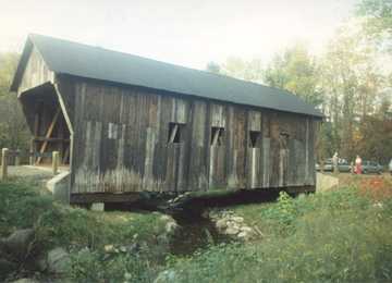
Westford Bridge. Photo
by C.M. Nagengast October 1987 Spade Farm Bridge.
Photo by C.M. Nagengast October 1987
Westford Bridge 45-04-05
The Arnold Graton Company was repairing the bridge and I missed "The Last of The Covered Bridge Builders" - who was due to arrive sometime in the near future. I just missed him about 4 or 5 times on this trip. The grandson, Arnold. M. Graton, Jr., who was in charge gave me his autograph and patiently explained the procedure used.
Photo by C.M. Nagengast October 1987
Spade Farm Bridge 45-01-02
This was a tough one to find. The bridge was off the highway and we kept passing it without seeing. The bridge was hidden by a tree between the highway and the bridge. We drove in to the store to ask directions and were told that Spade Farm Bridge was just outside the front door to the right. Never be too proud to ask for directions.        Photo by C.M. Nagengast October 1987
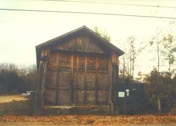
Amsden/Salmond
Bridge. Photo by C.M. Nagengast October 1987 Rutland Twin Bridge.
Photo by C.M. Nagengast November 1997
Amsden/Salmond Bridge 45-14-05
Moved in 1959, 1986, and 1987 from Weathersfield over the North Branch of the Black River to the present location over Sherman Brook, North East of Amsden on Henry Gould Road..
Photo by C.M. Nagengast October 1987
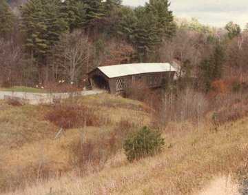
Rutland Twin Bridge 45-11-10
This former bridge is sitting on dry land since 1947 and is being used as storage by the local officials.

Photo by C.M. Nagengast October 1987
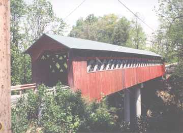
Twigg-Smith Bridge at
Brownsville. Photo by C.M. Nagengast October 1987 Cornish/Windsor
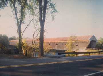
Bridge. Photo by C.M. Nagengast September 1987
Twigg-Smith Bridge, Brownsville 45-14- 17
This was half of the Garfield Bridge (45-08-05). It was destroyed by a wind storm in February 2002. The other half still stands in South Pomfret.
Photo by C.M. Nagengast October 1987
Cornish/Windsor 45-14-04
The longest (449 feet) of the last three covered bridges that straddle the line between the States of New Hampshire and Vermont..
Photo by C.M. Nagengast September 1987

Return to top

Joe Nelson, P.O Box 267, Jericho, VT 05465-0267, jcnelson@together.net

No part of this web site may be reproduced without the written permission of Joseph C. Nelson
Copyright © 2001, Joseph C. Nelson
This file posted April 11, 2002