THE BRIDGER
The Vermont Covered Bridge Society Newsletter Winter 2017 Issue #71
Events
Vermont Covered Bridge Society
Spring Meeting
April 14, 2018,
10:00AMQuechee Public Library
1957 Quechee Main Street
Quechee, Vermont 05059
The spring meeting will be a joint meeting with the National Society for the Preservation of Covered Bridges (NSPCB). Our speaker will be Devin Coleman, Vermont State Architectural Historian, who will be speaking on bridge builder Nichols Powers. The meeting agenda will be published in the Spring issue.
We Are Pleased to Announce...
We are pleased to announce that Dan Monger, our new Chair of the Membership Committee, is hard at work planning a membership drive, along with all of the other duties exacted by the committee's charter.
Also hard at work is Steve Miyamoto, our new Chair of the Publicity Committee. He has begun establishing a relationship with the media and other organizations to provide them with information about our Society's aims and activities - all of that as he continues supporting our website and FaceBook page.
A volunteer-run organization like the Vermont Covered Bridge Society needs worker bees like Dan, Steve, and Melanie, our new newsletter editor, to fulfill its mission.
We are asking our membership to please give serious consideration to the Society's still outstanding needs:
- Needed: A volunteer to assume the duties of the Events Committee Chair
- Needed: A volunteer to assume the duties of Treasurer
- Needed: A volunteer to take charge of the Covered Bridge Market Place at our annual meetings and on the website. The market place brings us funds to support our Save-a-Bridge program.
- Needed: Committee members for the Standing Committees, i.e. Bridge Watch, Communications, Events, Historical, Legislative Watch, Membership, and Publicity. The duties of each committee are described at http://www.vermontbridges.com/whatis.vcbs.htm#item5.
- Needed: Bridge Watchers. If there is a covered bridge in your locale, sign up as a bridge watcher and keep your Society informed of events involving your bridge.
- Needed: Reporter/correspondents to bring local covered bridge news to The Bridger. Please send them to Joe Nelson, jcarlnelson@yahoo.com or VCBS, P.O. Box 267, Jericho, VT 05465. He will share them with the newsletter and the Historical Committee.
For more information or to sign up for any of these positions, please contact Joe Nelson, Communications Committee Chair, jcarlnelson@yahoo.com or Bill Carroll, wcarroll@crocker.com
.Vermont Covered Bridge Society
Eighteenth Annual Fall Meeting
Middlebury, VermontSaturday, October 21, 2017
On October 21, 2017, eighteen supporters of the Vermont Covered Bridge Society met at the Ilsley Library in Middlebury to hear a very interesting talk by Robert McCullough, Professor of Historic Preservation, Architectural History, and Historic Preservation Law at UVM. He is the author of the book Crossings: A History of Vermont's Bridges, published in 2005 and written along with the Vermont Historical Society, in partnership with the Vermont Agency of Transportation. The book covers history, as well as design and construction of all types of bridges found in Vermont.
A PowerPoint presentation illustrated the various approaches to covered bridge preservation and the various systems currently used and their effects on recent Vermont covered bridge upgrades.
Professor McCullough's talk elaborated upon the reasons for covered bridge preservation and stated the following objectives:
- Structural integrity
- Materials
- Functional integrity (setting, views, location) - that to modify any of these reduces this integrity
- Permissibility - Is it OK?, i.e. co-functional structural system working in conjunction with the historical system while encouraging the flexibility of treatments - secondary would be to use Glulam materials.
The Quinlan Bridge was modified using steel beams. The Williamsville Bridge was modified with Glulam beams, as were the Union Village Bridge and the Kidder Hill Bridge.
Professor McCullough mentioned the need for inventive solutions for some bridges that need repairs. He also presented recent work done on the Williamsville Bridge in Newfane and the Green River Bridge in Guilford, along with the question of whether or not to replace the Longley Bridge in Montgomery. It was replaced.
The Board of Directors had decided there would be no business meeting at the fall meeting. Consequently, there was no Treasurer's Report or reports by other committees.
Some members brought their favorite bridge items to share with the membership. Tom Carpenter brought his covered bridge postcard collection and his photograph album of Vermont Historic Site signs.
Bill Caswell, President of the National Society for the Preservation of Covered Bridges (NSPCB), noted that the Spring 2018 meeting will be a joint meeting with the Vermont Covered Bridge Society. This combined meeting will be in Quechee, Vermont, at the Quechee Public Library, on Saturday, April 14, 2018, at 11:00 a.m. The featured speaker will be Devin Coleman, Vermont State Architectural Historian, who is an expert on Nichols Powers.
Paul Vasczy of Salisbury had been slated to speak on the lack of progress on the decision of whether or not to replace the burned Salisbury-Cornwall covered bridge. Mr. Vasczy arrived too late to speak, but Irene Barna learned that the problem is a lack of funding.
Secretary
Publicity Committee
Welcome from the Publicity Committee. I am looking forward to the opportunity to promote the Vermont Covered Bridge Society and Vermont's covered bridges. I will be using some of the tools that are currently in place to accomplish this goal, including the VCBS website, Facebook page, and Twitter account. As time goes on, I will be exploring Instragram and Pinterest as additional resources.
Though I am recently retired, I could always use a hand. There are a large number of local newspapers, radio, and television stations that need to be communicated with to promote VCBS events.
I was surprised by how much was involved in promoting the fall 2017 meeting. If you would like to work with me in these areas and with the media, please let me know. I can be reached at spmiyamoto@gmail.com.
Publicity Chair
Membership
My name is Dan Monger, and I am the new VCBS Membership Committee Chair. I am a relatively new member since 2015 and transitioned into this position in August. I would like to update everyone on present efforts to grow the VCBS membership. I will initially step forth from an area of strength - chemistry. I will attempt to provide such a perspective, if such information exists, for our First Quarter 2018 edition of The Bridger.
This September, I reached out to our approximately 140 members to gather changes in contact information, memberships, and anniversary dates. This, as well as the other tasks delineated below, are works in progress. I am using the USPS where emails failed to provide such updates.
I am compiling a list of public libraries in mid to large populated towns and cities in Vermont. Since over half of our members live out of state, I am also listing public libraries in large cities in Pennsylvania, Ohio, and Indiana. These are the states with the largest numbers of existing covered bridges. I intend to circulate a cover letter, along with our VCBS brochure created by Joe Nelson and Wendy Payson. I hope to spark interest in people who live in areas with covered bridges. People who frequent libraries are inquisitive, and citizens of these four states are likely to routinely see and appreciate these beautiful structures as they go about their daily activities. We would provide them the opportunity to find out more by joining the VCBS to associate and discuss the topic with like-minded people.
We'll see if this approach is successful and the expense is minimal, with postage and publication costs. There are three local printing companies in the Middlebury/ Vergennes area I have dealt with over the years. I am in the process of requesting bids for printing 2000 copies of our brochure. If there are companies you think I should also consider, please notify me by email at teelmonger@gmavt.net. Down the road, we will entertain the creation of a subsequent version of our brochure, if there is enough interest from our membership. I encourage ideas and changes to add, which I will collect in a file for future consideration.
Another approach to increasing membership is to follow-up on a lead contact, Cindy Roberts, Brochure Program Manager, Vermont Welcome Centers. There are 19 welcome centers in our state. We are considering a proposal to provide brochures to the top four welcome centers as a starting point.
until the next issue
Bridge Watch
WGN 45-06-08#2
Montgomery, Vermont
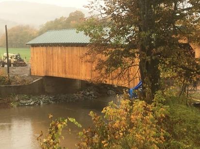
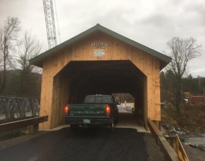
Work on the Longley covered bridge in Montgomery is complete, and the bridge was opened to traffic on November 6. The first to drive across were Stanley and Lucinda Longley (pictured below), whose nearby farm has been in the family for over 150 years.
Jim Ligon photo
Jim Ligon photo
Ray Hitchcock, a Remembrance
The newsletter article that follows was sent to my email address in search of addresses for Adrienne. I hope I was helpful.
Ray, a Vermonter, retired from the Minnesota Department of Natural Resources, returned to Vermont and joined us, taking on the role of Chairperson of the Windham County Bridge Watch Area as a resident. He went right to work, establishing relationships with the owners and lovers of the covered bridges there, winning many friends for us.
Ray Hitchcock: A life dedicated to conversation

By Mimi Barzen
Minnesota Department of Natural Resources
The Department of Natural Resources (DNR) was either lucky or very astute when they hired a young Vermont forester named Ray Hitchcock. The division (and later department) got way more than they bargained for. Throughout his 35 years at the DNR, he tirelessly advocated for professional, science-based natural resource management. An effective change agent with a passion for the great outdoors, he aimed to manage to the best of his ability. Ray never stopped learning. New problems or dilemmas always arose, and he committed to solve them.
Ray started his career as a district forester in Bemidji. Tom Baumann, who worked with Ray in the DNR recalled, "Ray ascended from the field to assistant area supervisor to area forester to assistant fire program leader. One year later, he had the top spot in fire. But, he didn't stop there, for he rose quickly to become the director of forestry. He continued to advance, becoming assistant commissioner for operations and, finally, acting commissioner as the state transitioned to the Ventura administration." Each step of the way, Ray left his mark, sometimes to the displeasure of the higher-ups.
Larry Hegstad, another retired forestry employee, shared the best story, "When Ray was a forester in Bemidji, he got tired of chasing multiple fire starts caused by trains passing through his work area. He decided it was time to put a stop to it in the most direct way he could – by parking his fire rig across the tracks of an oncoming train, daring it to hit him." The train stopped and so did the fires.
Other accomplishments stood out. As the head of the fire program in 1976, Ray played a big role in starting the air program. Thanks to him and his staff, whom he encouraged to try new approaches, the aerial program took off toward what it is today. Without Ray's leadership, building the program may have taken much longer. He wasn't afraid to try new techniques and encouraged his staff to do so as well. Always a strong supporter of his employees, Ray stood behind them, even if their idea failed. Ray was also instrumental in updating the Timber Sales Program from mostly informal sales to the auction process used to this day. He instituted changes gradually to avoid upsetting loggers.
The way we manage forests today also reflects Ray's early adoption of considering ecological factors when growing and harvesting trees, using current scientific research, of course. Recognizing the foresters needed more detailed information on the forests they managed, he instituted the process of collecting resource data, propelling forest management into the high technology it is today. While working in the commissioner's office, he opened up the lines of communication between the squabbling divisions to create a cohesive team.
Ray looked out for his employees. He often encouraged younger foresters to take promotions and advance their careers. He also believed in a diverse workforce and strongly supported women and minorities to join their predominately male colleagues. He respected American Indian treaty rights and cooperated with Indian natural resource managers. Ray was respected and well-liked inside and outside the DNR. His dry sense of humor helped, and he deployed it often to defuse difficult situations.
After devoting his entire professional life to protecting Minnesota's natural resources and serving the department and colleagues he loved, Ray retired in 1999. He eventually moved back to his native Vermont with his beloved wife, Adrienne. Retirement didn't slow him down, though. He quickly became a leader in the local land trust, helping to purchase land and develop trails. He also advocated for Vermont's more than 100 covered bridges as [a] director of the Vermont Covered Bridge Society. He and Adrienne managed to visit 80 of them, most of them on their motorcycle before ALS rendered him too weak to handle the controls.
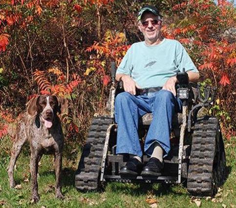
In 2008, Ray was diagnosed with ALS, also known as Lou Gehrig's disease, a degenerative and ultimately fatal disease that takes most people's lives within three years.
Steve Thorne, who worked with Ray in the commissioner's office and was a close friend said, "He met this challenge as he had many others - with courage, determination, and good humor." Defying the odds, he lived years longer than average, remained active, and in generally good spirits to the fullest in spite of his severe handicap, motoring around the woods in his all-terrain wheelchair." And he left quite a legacy for the DNR. It wouldn't hurt if we had more folks like Ray, minus the railroad incident.
A Covered Bridge Tour - The Bridges of Lyndon, Vermont
A visitor to the town of Lyndon is greeted by an ornate sign posted on U.S. Route 5 across from I-91 exit 23 at Lyndonville: "Welcome to Lyndon, the Covered Bridge Capital of the Northeast Kingdom."
The town is the home of five covered bridges. Four of the five bridges in Lyndon have an appearance unique to this region - the Lyndon look, perhaps. The bridges - Chamberlin, Miller's Run, Randall, and Sanborn - have wide flaring roofs with generous overhangs at eave and gable end and use only the overhang to protect the truss from the weather. The siding, only a few feet high, exposes the interiors to light and air. The visual effect is that of a floating roof. A fifth span, the School House Bridge, contrasts with the other four. It is one of only two covered bridges in Vermont with the truss completely enclosed, not only on the bridge exterior, but on the roadway side as well.
Except for the Sanborn Bridge, the Lyndon bridges use the queenpost truss. The Sanborn Bridge is one of only three Paddleford truss bridges surviving in the state.
Aware of the importance of the old spans to the community, the Lyndon Area Chamber of Commerce and the Town undertook a revitalization program for their bridges and their sites. The driving force was the Bridge Committee chaired by the late Jim Fearon, a retired park and recreation director.
In November 1998, the committee submitted The Lyndon Covered Bridges Preservation and Recreation Use Plan, covering the Randall, School House, Chamberlin, and Sanborn bridges. The plan stated:
"With the success in 1998 of the Volksmarch program, which was sponsored by the chamber, hosting 200 visitors, most from out of state, we must continue to improve the general appearance of the bridges and make them user friendly. Parking, picnic tables, falls observation decks and interpretive signage can make the bridges an important part of the Lyndon experience."
The plan listed improvement projects for each bridge and proposed responsibility for them to several Lyndon organizations, including the Town of Lyndon Highway Department, the Rotary, the Grange, the Dartmouth-Hitchcock Medical Center, and students from Lyndon State College and Lyndon Institute. The projects for the School House and Sanborn bridges were completed in 1999; installation of roadside posts, topsoil and seeding, planting flower beds and trees at the School House Bridge; and the repair of the siding and painting of the portals of the Sanborn.
"The staff at the medical center has volunteered to do the painting on the School House Bridge and to keep the bridge up," said Fearon. "For the Chamberlin Mill, we're talking about additional visitor facilities, including an observation deck to view the double waterfall under the bridge. It's a 1790 mill site area and a lot of the original mill foundations are still there."
Rhode Island Doctor Jonathan Arnold and his associates were granted the town lands by the General Assembly of Vermont. Named for Arnold's eldest son Josias Lyndon, the town was chartered on November 20, 1780.
The Honorable George C. Cahoon described the Lyndon of those years in The Vermont Historical Gazetteer: "[It is] interspersed with hills and valleys and carved out by the many tributaries of the Passumpsic, forming into one beautiful river, its waters uncommonly cold and pure. Several sites of excellent waterpower for mills and machinery are located [there]."
When Lyndonville was incorporated in 1880, Isaac W. Sanborn, Justice of the Peace, led the organization meeting. Among the officers elected were Isaac Sanborn, town clerk and treasurer, and J. C. Jones, trustee and water commissioner. These gentlemen played important roles in the histories of the town's wooden bridges.
With interior and exterior painted white, the neat little School House Bridge, WGN 45-03-03, stands in a carefully maintained green. Built in 1879, the queenpost trusses are completely sheathed with planking, the structure additionally protected by overhanging eaves and the gable-end extensions above the portals. The portals are triple-arched and supported on enclosed corbels finished with pilasters. A pedestrian walkway is tucked under an eave overhang with the walkway separated from the bridge deck by the truss. Originally, there was a walkway on each side to accommodate the comings and goings of the children from the nearby school, but there is no record of when or why one walkway was removed. Construction began on the Lyndon Academy and Graded School in 1871. Two new roads provided access to it, and one of them crossed the South Branch to South Wheelock Road. In the October 4 issue, the editor of the Vermont Union panned a bridge completed there in 1872; "The most extravagant piece of work we have seen in a long time...if it cost anything, the town will be cheated..."
The unpopular bridge didn't last very long. On December 12, 1879, the Vermont Union reported: "The new bridge on School Street is completed and is a job well done. John Clement laid the abutments, which is a guarantee that the work will stand. J. C. Jones drew the plan of the woodwork and Lee Goodell framed it and supervised the building..."
In 1931, John B. Chase wrote in the Vermont Union Journal: "The bridge had its hardest test in the 1927 flood, when it was tipped up till the chances looked about 100 to 1 that it was going out, but it withstood the onslaught of the rushing water and debris piled against it. As the water went down, the bridge gradually settled back into place, little if any damaged."
In 1971, construction of Interstate Highway 91 required relocation of the road served by the bridge. The owners of a local business donated an acre of land. Refurbished and surrounded by a small park created with local donations, the bridge was placed on the National Register of Historic Places.
The 42-foot bridge crosses the South Wheelock Branch of the Passumpsic River off South Wheelock Road. Take Route 5 west from I-91 exit 23 and proceed for 0.2 miles, then turn onto South Wheelock Road. Continue west on South Wheelock Road 0.4 miles to find Mill Street and the Chamberlin Bridge.
The Chamberlin Bridge, WGN 45-03-04, serves York Street and Mill Street west of Route 5. The most westerly of Lyndon's string of five bridges, the bridge has also been known as Chamberlin Mill Bridge, the Sawmill Bridge, and the Whitcomb Bridge.
The 66-foot structure spans the North Branch of the Passumpsic River. The original non-mortared stone construction is still visible in the north abutment. The south abutment was faced with concrete, probably in the 1960s. The bridge is in use daily by light traffic.
The construction features open sides, the queenpost truss protected by the wide eaves of an overhanging metal roof. The extended gable ends and the truss are painted white. The gable sheathing, cut high over the roadway, dips to the corbel ends and up again to the ends of the eaves, all in straight lines.
It is not known when the present bridge was built, but it is known that it is not the first on this site. A 1795 map shows a bridge crossing the stream here - it and the Chamberlin Bridge's other predecessors were probably open bridges. The Vermont Union newspaper reported in August 1881: "The Chamberlin Bridge at the west of this village [Lyndon Corner] is having a new abutment and is to be built over into a covered bridge." Selectman W. W. Heath superintended the work.
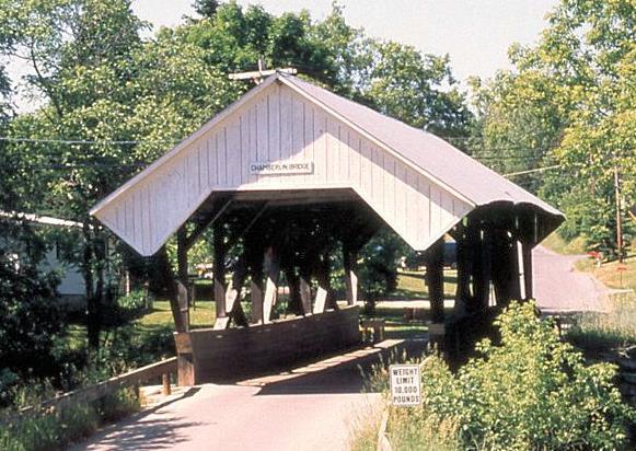
Photo by Joe Nelson
Ephraim Chamberlin built a gristmill here before 1817, and a sawmill was added later. Anson Miller of Dummerston built a wagon and sleigh works at the north end of the bridge in 1818. It was here that the famous Lyndon Cutters were built. These horse-drawn buggies weighed a mere 175 to 275 pounds compared to the usual four hundred pounds or more. In 1840 Myron Chamberlin, Ephraims's son, built a new gristmill. Sharing the waterpower with the Chamberlins and the Millers in this busy place were a carding mill, a fulling mill, a bark mill, a saddler's shop, and an oil mill.
Through the years, the mills changed hands several times but carried the Chamberlin name until 1905. Harold Whitcomb bought the works at that time and converted them from water power to electricity. When Whitcomb sold out in 1937, the mills and the bridge reverted to the Chamberlin name.
The great flood of 1927 struck during Whitcomb's time. Luther Johnson commented in his Vermont in Flood Time: "At Lyndon village...all the bridges along Little York Street, except the one at Whitcomb's Mill, were carried away." The mill the bridge was named for burned in the 1950s. The stone foundations can still be seen.
To view the three bridges to the north, return to Route 5. There, turn left and go north about two miles to the Sanborn Bridge.
The Sanborn Covered Bridge, WGN 45-03-05, has come upon hard times. It was closed when, during the summer of 2013, flood damage caused lower and upper chords on the downstream side to fail, allowing the bridge to sag more than two feet.
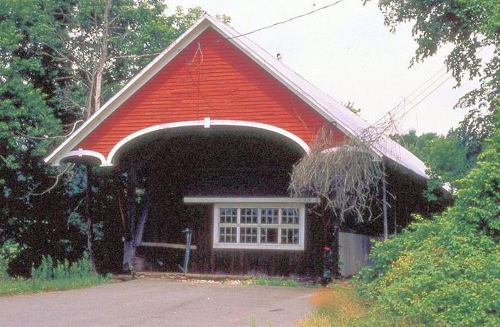
Photo by Joe Nelson
On August 11, 2013, a team committed to the rescue of the failing Sanborn Bridge gathered at the bridge site, including David Wright, President of the National Society for the Preservation of Covered Bridges; Tim Andrews, of Barn & Bridges of New England; Jan Lewandoski, of Restoration of Traditional Buildings; Eric Gilbertson, of the Preservation Trust of Vermont; Arthur Elliott, owner of the bridge; and others.
Both the upper and lower chords of the downstream truss were broken, and that side of the bridge was kept from collapsing into the Passumpsic River by the bridge flooring and roof system held in place only by the upstream truss. It was apparent that the first order of business was to stabilize the bridge.
Bridge wright Tim Andrews built a stone island under the bridge's downstream chord, set two 25-ton hydraulic jacks atop a cribbing built on the island, exerting 35 to 38 tons of lift, raised the broken parts into position, and re-enforced them with 5"x12"x42' timbers, completing the stabilization project.
To build the island, 20 cubic yards of stone were brought to the site. Two-thirds to three-quarters of this was carried to the river by hand in buckets, all of which had to be removed from the river by December 1, it is assumed by buckets.
With the bridge stabilized, it needs to be removed from the river and set two to three feet above the ground to await further restoration. The cost of the stabilization was estimated to be $65,000, and removal activity may cost as much as $275,000. The restoration phase has not been cost estimated, and the bridge remains over the stream, the work incomplete.
Funding the work is the biggest problem. The bridge is privately owned and is not part of the state's road system, so unless a public or nonprofit organization takes title to the bridge, there are apparently no grants available.
Why is it important to save the Sanborn Bridge? It is the last example of the Paddleford truss at the pinnacle of its development in Vermont. According to research done by Richard Sanders Allen, it may possibly have been built by Peter Paddleford's son in 1869. When the bridge is gone, an important portion of Vermont's inheritance will go with it.
After the flood of 1927 and probably also due to the "modernization" of our bridges, by 1997 there were only three Paddleford structures left in Vermont. In November of that year, the Irasburg Bridge was lost to arson. It was replaced with a replica, using a non-historic version of the truss. The other Paddleford is the privately owned Lords Creek Bridge, which is in the last stages of decay.
The handsome Sanborn Bridge is typical of the Lyndon bridges in the construction of the roof – generous eave overhang and gable ends extended on corbels. The gable sheathing is painted red under a sharply pitched roof. The portals are triple-arched and trimmed with white molding. There is a pedestrian walkway on one side of the main deck.
A road and a bridge were constructed on Benjamin Sanborn's meadow in 1858 to connect Lyndon Center with farms on the west side of the Passumpsic. The type of bridge built there, or who the builders were, is unknown. The width of the river required a bridge span of 120 feet, a distance beyond the capabilities of the queenpost truss commonly used in the area, but within the range of Paddleford's truss. Ithiel Town's plank lattice truss would have qualified, but for some reason the Town truss is not found in this part of Vermont.
The Sanborn now spans the West Branch of the Passumpsic River, a few yards west of Route 5, near the junction of Route 114. In 1960, covered bridge restorer Milton Graton moved the bridge through the streets of the village to its present location. Owned by the motel beside it and no longer serving as a highway bridge, it has housed a series of businesses and the motel grounds maintenance equipment.
To view the Miller's Run and the Randall bridges, continue north on Route 5 to the junction of Route 114. There, turn left and drive 0.5 miles to the Miller's Run Bridge. To view the Randall Bridge, turn right and drive 1.7 miles.
The newly reconstructed Miller's Run Bridge, WGN 45-03-06#2, is clean and spare with no ornaments. It is painted white inside and out, with the low siding exposing the queenpost truss. The bridge was originally built in 1878 and was a no-nonsense Yankee answer to the need to cross a river.
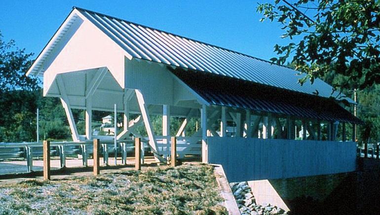
Photo by Joe Nelson
The queenpost trusses of the original bridge were incorporated into the reconstruction to support only the roof. A modern steel structure under the wooden deck supports the roadway. The reconstructed bridge is true to the Lyndon look, with its open sides and flaring roof. The 54-foot bridge is still single-lane, but it is a bit wider - the old tie beams were replaced with longer timbers of southern yellow pine. The new span features an attached footbridge not found on the original. Also new is the green enameled standing-rib metal roof. The simple triangular gable ends were replaced with geometry closer to that of the Chamberlin and Randall bridges.
The town sold the bridge to the Lyndon Chamber of Commerce for one dollar.
The bridge replaced in 1995 was not the first to serve here. The Board of Selectmen levied a special tax in 1800 to build a span near "the mount of Miller's Run." What probably was an open bridge was repaired in 1816 and rebuilt in 1841. The first reference to a "covered bridge" at this site appeared in the Vermont Union in August 1878: "The Selectmen have completed a new covered bridge over Miller's Run. It is a new style bridge for these parts and is said to be the best in town." E. H. Stone drew the plans and supervised construction.
The new bridge over Miller's Run continues to serve travelers on Route 122. It is located in the northwest corner of Lyndonville Village, 0.5 miles west of the junction of Routes 5 and 114, and one mile east of I-91 exit 24.
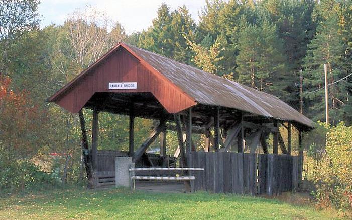
Photo by Joe Nelson
The old Randall Bridge, WGN 45-03-07, is retired. It stands next to Barrington Bridge Road, just off Route 114 north of Lyndonville, about 1.7 miles from the junction of Routes 5 and 122. Spanning the East Branch of the Passumpsic River, it serves a footpath and snowmobile trail. In 1965, a new concrete and steel bridge was built here. The wooden bridge was left standing as an example of the craft of the covered bridge builders of a century or more ago. One would like to hope, since the bridge was built in 1865, that Civil War veterans might have found work there.
Like the Miller's Run Bridge and the Chamberlin Bridge, the Randall is constructed with open sides, the queenpost truss protected by the wide eaves of the metal roof. The extended gable ends are stained brown. The gable sheathing, like that of the Chamberlin, is cut high over the roadway, dips to the corbels and up again to the ends of the eaves. The interior and truss are unpainted.
From the Archives
Back in the late fall of 1864, Confederate raiders assaulted St. Albans, Vermont, robbing the banks there and attempting to burn the place with Greek fire. They fled the scene, heading for Canada by way of the village of Sheldon. There they seized a wagonload of hay, inserted it into the covered bridge, and set it afire to foil the pursuing posse. The posse arrived in time to shove the hay wagon out of the bridge.
Eight Buildings and Bridge Burn
Eight buildings, comprising virtually the entire business section of the town were leveled to the ground, and the two sections of this village were cut off from each other by the destruction of the highway bridge across Sheldon Creek, a tributary of the Missisquoi River, last night when a fire of undetermined origin swept through property on the east bank of the [creek] with a loss of $75,000.
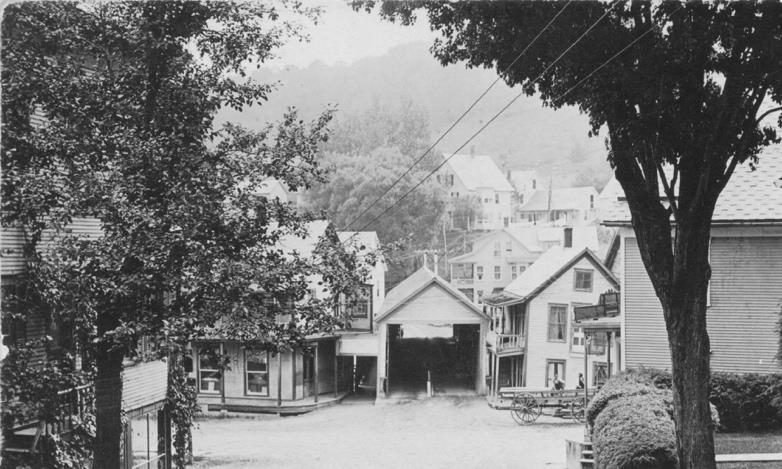
postcard, circa 1920s
Whipped by a brisk north wind and too far advanced to be subdued by hand apparatus at hand when discovered raging in the W. W. Mower general store at about 11:30, the blaze burned itself out, the wooden buildings in its path providing ready tinder.
Any hope of controlling the fire vanished when the 150-foot covered bridge connecting the east side of the village with the main highway caught fire. Aid had been hastily summoned from Enosburg Falls, but when the motorized apparatus arrived, the bridge was afire and the firemen could not get near the burning buildings. They devoted their efforts to prevent the flames from crossing the [creek] to the residential section and hotel on the west side.
Today the bridge was gone completely, timbers having been carried away by the swollen stream as fast as they dropped into it. Not a wall was standing in the area ravaged by the fire.
The Mower block which housed the general store on the first floor; the dance hall and the Masonic hall on the second floor; another adjoining Mower building which formerly housed a tin smith shop; the W. C. Marsh block which housed the post office and barber shop operated by Mose Larabee; Hood's Creamery, an unoccupied dwelling house belonging to the creamery; the blacksmith shop formerly operated by Briggs Northrup; the cheese house near the Hood creamery; a horse shed and the large wooden highway bridge all were totally destroyed.
Of the buildings owned, the only ones occupied by business interests were in the Mower store, the post office and barber shop. The creamery and the cheese plant had not been in operation for some time, farmers from this vicinity taking their milk to the creamery at Sheldon Junction.
The origin of the fire is unknown. It was first discovered by Otis Reed in the rear part of the Mower general store and had gained such headway that, although volunteer fire fighters were on the scene quickly, nothing could be done to stop the fire from spreading. The village has no fire department and the only water that was procurable was from the nearby creek. The flames raced through the Mower block and nothing was saved with the exception of a few articles from the post office. A call for help was sent to the Enosburg Falls fire department, which responded with their motorized fire equipment. With the highway bridge in flames the Enosburg fire fighters had to be satisfied with remaining on the west side of the river. Much credit is due to the visiting firemen for their work in saving the C. H. Jones building which houses the Jones meat market and grocery store situated just across the [creek] from the burning buildings.
Volunteer fire fighters worked hard in saving the railroad station and other buildings which were being threatened by the flames.
With the burning of the highway bridge it cuts the village in two and as a result, school commissioners after considering conditions this morning announced that there would be no school this week in the village school which is situated on the east side of the river.
The loss is only partially covered by insurance and there is very little hope of any of the burned structures being rebuilt with the exception of the highway bridge. Town selectmen stated this morning that work on building a new bridge will start as soon as possible.
The east section of the village was without electric power or telephone service during the night and both the Public Electric Light Company and Telephone company had men at work early this morning making repairs.
SHELDON, April 5, 1932 - Workmen under the direction of the town selectmen were hastening today to restore contact between east and west sides of this village by the building of a temporary foot bridge across Sheldon creek where the 150-foot wooden highway span was destroyed by fire Sunday night along with eight other structures on the east bank of the creek.
An engineer from the state engineer's office surveyed the approaches to the old bridge this morning and Chief Selectman H. P. Marsh stated that he hoped that plans and estimates on a new bridge could be prepared soon.
The cause of the fire which brought a loss of $75,000 in the business section of the village, has not been determined. Selectman Marsh said he had heard of no plan to investigate it by the state fire marshal's office.
VCBS Lending Library:
Research Source
We are in that between seasons time when our trees stand naked in the chill breezes and our fields are stark, browned, and uninviting. But not for long! The snows are coming to brighten everything! That's when our photographers will be out again to catch their favorite subjects, not with the colors of the fall season, but with the sharp brightness of a crisp winter. A sunny day with warm color, sharp shadow, and a subject in which one combines some blue sky and a bit of the water running under their favorite covered bridge.
On the days not good for exploring our bridges, don't forget our lending library and the pleasure of curling up with a good book next to your fireplace.
The Vermont Covered Bridge Society has assembled a lending library available through media mail to all society members in good standing.
Librarian Warren Tripp has created a detailed book list complete with a description and critique of each book. Copies of the index are available by mail, or you may contact Joe Nelson for an electronic copy at jcnelson@together.net or go to http://www.vermontbridges.com/whatis.vcbs.htm#item7. A borrower can contact Warren Tripp, who will send the book by Postal Service Media Mail. Books are returned the same way.
Send Warren the complete title of the book(s) you wish to borrow. He will respond with the mailing cost and mail the order when the fee is received. The borrower is then responsible to return the item(s) in a reasonable time, preferably no longer than two months. Contact Warren Tripp, P. O. Box 185, South Barre, VT 05670, fftwbt@yahoo.com, phone 802-584-3545.
For Sale
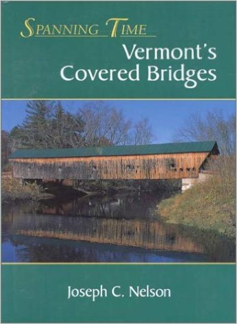
Spanning Time: Vermont's Covered Bridges features 102 color photographs of Vermont's covered bridges in fifteen chapters, each a guided tour. The tours are complete with maps, commentary on the uniqueness of each bridge, and historic highlights about the towns and villages in which the bridges stand.
An appendix provides: A Summary of Vermont's Covered Bridges, listing information on each; A Covered Bridge Glossary, describing the details of a covered bridge; A Bridge Truss section, explaining how trusses work with drawings of the trusses used in Vermont; The Bridge Builders, providing thumbnail biographies of people who designed and built the bridges; A Covered Bridge Reading List, for bridge and history buffs; A detailed Index. Spanning Time: Vermont's Covered Bridges: 7" x 10", 288 pages. Published by New England Press at P.O. Box 575, Shelburne, VT 05482. Spanning Time is available directly from the author for $39.00, free shipping.
Go to Spanning Time: Vermont's Covered Bridges Special Book Offer
Also see:
www.vermontbridges.com/bookreviews.htm.
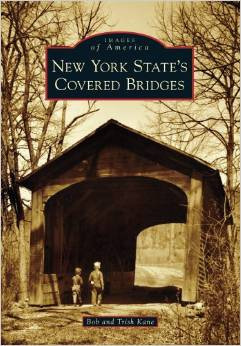
New York State's Covered Bridges - When one typically thinks of covered bridges, New York is not the first state to come to mind, but New York once had over 300 covered bridges. Floods, fires and progress have claimed all but 32. Readers will enjoy seeing NY's current bridges, including the oldest existing covered bridge in the U.S., the Hyde Hall Covered Bridge, located in Glimmerglass State Park, and the world's longest singlespan covered bridge in the world, the Blenheim Covered Bridge, washed away by Tropical Storm Irene in 2011. This book also highlights the Theodore Burr Covered Bridge Resource Center in Oxford, NY, the first ever center of its kind specifically designed for covered bridge researchers.
To obtain a copy of the tour, contact:
Visions of Vermont Art Gallery Jeffersonville, Vermont
https://www.visionsofvermont.com/
802.644.8183
A special sale for the benefit of the Vermont Covered Bridge Society featuring the works of Eric Tobin. All proceeds of the unframed prints go to the VCBS. Sale of the framed prints will be shared 50/50. They are all Giclèe on acid free paper. The glass is non-glare artist's glass.
- Print Size
- 10 x 12
- 16 x 20
- 16 x 20
- 20 x 24
- Format
- Unframed
- Unframed
- Matted and Framed
- Matted and Framed
- Price
- $125
- $175
- $550
- $850
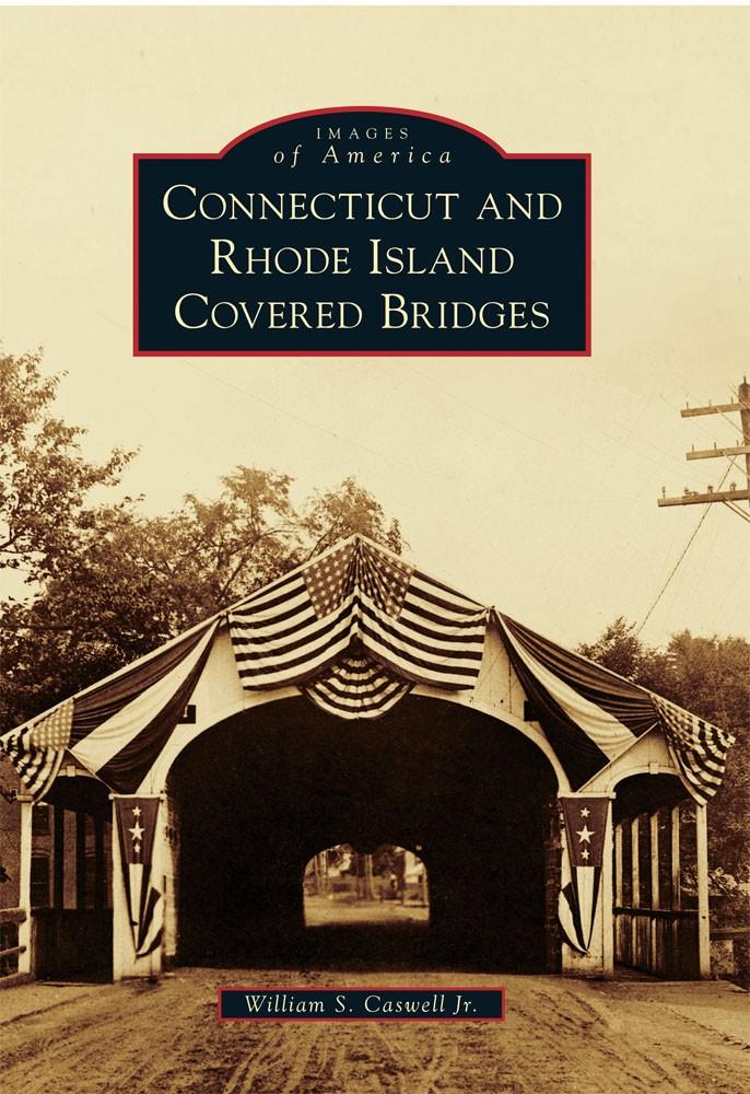
Connecticut and Rhode Island Covered Bridges-Price reduced
During their heyday in the mid to late 1800's, more than 150 covered bridges dotted the landscape of Connecticut and Rhode Island. Since that time floods, fires, and progress have claimed all but two of the historic structures. With over 200 images, this book provides insight into the covered bridge history of an area that has not been well documented in the past.
To order your signed copy, send $20.00 to:

Covered Bridges of New England - DVD. Produced by Ocean State Video of Rhode Island for Public Television. On Sale: $20.00. Profits will go to the Vermont covered Bridge Society's Save-A-Bridge Program. For your copy send $20.00 plus $2.50 shipping to Joe Nelson, P.O. Box 267, Jericho, VT 05465-0267.
- President
- Bill Carroll
- 5 Hutchinson Lane
- Lenox, MA 01240
- wcarroll@crocker.com
- VP/Communications
- Joe Nelson
- PO Box 267
- Jericho, VT 05465
- jcarlnelson@yahoo.com
- Secretary
- Irene Barna
- 7 Forbes Circle
- Middlebury, VT 05753
- ibarna@middlebury.edu
- Membership
- Dan Monger
- teelmonger@gmavt.net
